In case you wanted to do this duathlon next year this post shows the race course including the elevation profile.
The first picture shows the GoogleEarth map of the entire race course. The run course is on the right side of the map with all the lap markers. The bike course is the big loop around the run course. The different colors show my HR zones, and should give you a pretty good idea about the hills. The climbs are where my HR went up (yellow, gray) and descends are where I got back to green.
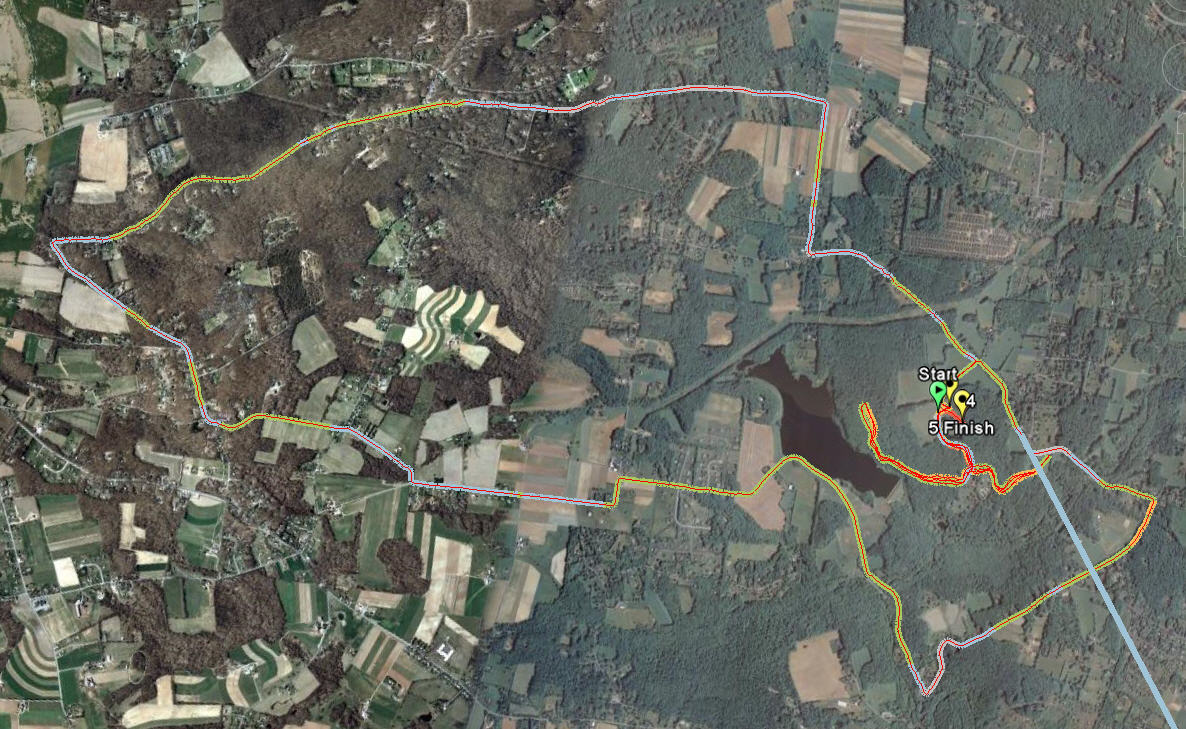
Second picture shows the detail of the run course. Don't get confused with all the lines there - I ran the course twice and since the course is a big reverse T there are quite a few lines. The details of the run course are included below.

The elevation profile below shows the entire course. The run course is on the first about 22 minutes which took me to run the 5k and get through T1. The next 43-44 minutes show the bike course and the rest is the repeat of the run course on the second run. As my speed/distance unit gave out on the second run I can not show you the course profile over distance, but only over time which may distort some of the hills. But here are some figures that will make the course little easier to read.
The ascent on the bike course is about 300 meters (980 ft), the biggest climb is approximately 100m (330 ft) over the 2.7 km (1.7 mi). But you can see that there is hardly a flat section on this course where you could just fly. Well on those this year there was pretty strong wind (we were lucky that the race was not on Saturday when we had much stronger winds in the area).
The run course has ascent of about 70 meters. The course is basically either downhill or uphill. There is no real flat section on the run course that I noticed. What is really challenging on this course is the sequence of the rolling hills - you start downhill and turn right onto a trail road with plenty of little stones that make the footing pretty challenging. Then run few uphill and dowhill segments, loop around the campground and head back. When you get back to the road you head to the other side of the park on the road. This is downhill followed by a slight uphill and then false flat section to the entrance to the pack. Turn around the cone and head back to the start line. Which means climbing all the way up (notice the climb on both parts of the run.


No comments:
Post a Comment