I have been silent over the past few days, but that is only because the body needed well deserved rest and recovery time. Over the past few days I was pretty much sitting around and resting my leg. It got swollen on Monday and Tuesday around the ankle so I gave it enough rest before putting any stress on it. The swelling went down on Wednesday so yesterday I did first short bike ride on the trainer and in the evening went out for a walk with my son. I took the RS800CX with me for the walk with the G3 sensor to see how it performs. I also had the S3 sensor in my shoe, but it for some reason did not activate so I'll need to take it with me next time we go for a walk.
As we walked I took few laps to see how they show in the Google Earth and how the whole thing is implemented in the PPT5. Here are few pictures of how the walk turned out.
The first picture shows the exercise - yeah it was a very slow walk. I did not want to put stress on the leg and also walking with three years old involves few stops to check out various things - like a leave, manhole covers, trees, dog, car, house, and many other things. It is also like walking with Spanish inquisition... You with kids understand what I'm talking about.
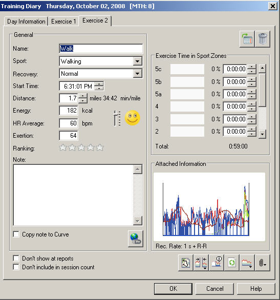
The second picture shows the PPT5 window with the location information - not yet overlaid over a map (like Garmin does in the Training Center), but ready for export to GoogleEarth or GPX viewer. Since I have only GoogleEarth I tried that option.
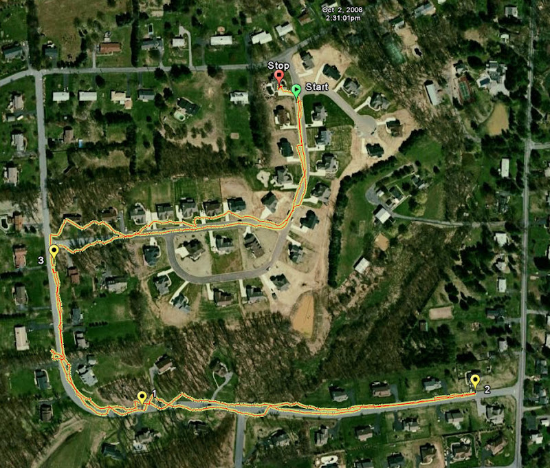
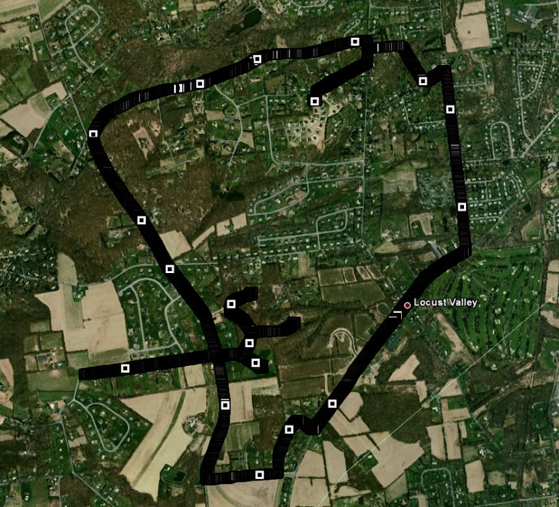
On this picture you can see the GoogleEarth depiction of the walk. Contrary to the path shown we did not walk on other people lawns, but walked on the road. The section close to lap3 where we are shown to walk on the lawn in both directions has pretty good tree cover which can explain the error. But I did not walk in straight line, but instead walked back and forth as my son drove his bike next to me.
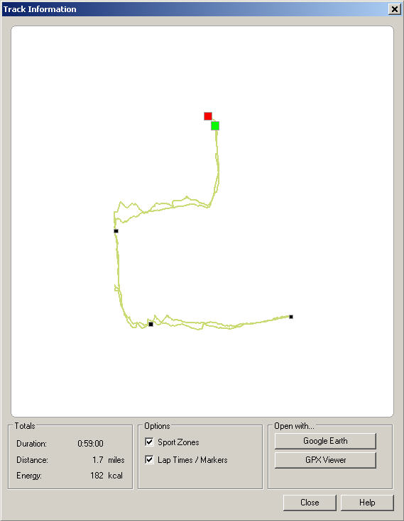
Third picture shows the lap information that is shown in the GoogleEarth. Pretty good information that get into GoogleEarth that helps analyze the segments much better than plain analysis in the PPT5 (which is still available, this is just an additional set of features Polar added to RS800CX).
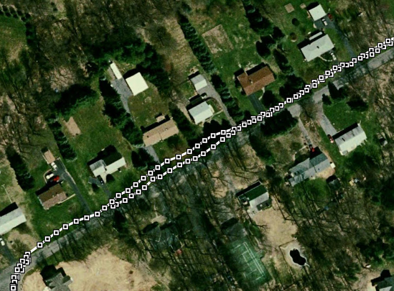
This picture is not from Polar, but from Garmin Forerunner 405 from one older run in the same area (longer than what we walked). And it is here just for comparison purposes. You can see that Garmin captures each coordinate and depicts it as a square so it appears to stay on the road.
But zoom in and you will see that even with Garmin the GoogleEarth shows you running on the lawn next to the road. Road is the gray line to the right of the Garmin captured path.
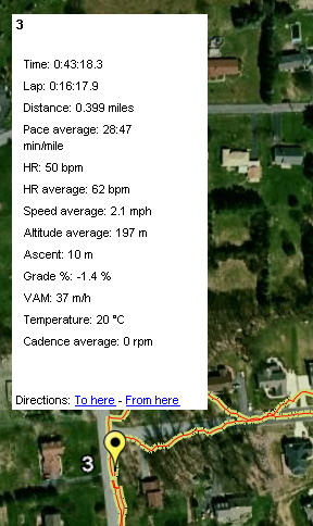
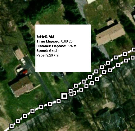
Last picture shows the information Garmin provides for each captured coordinate. It does not specifically highlight the laps and the provided info is almost useless - I'm not sure if anyone can use it. If you can let me know. I just can not imagine I would have use for immediate pace for each point and how far I traveled between two samples. But maybe I'm missing how to use it.
Overall I like the way Polar depicts the path little better than what Garmin provides. I just wonder if and how Polar will depict the different zones - the example above is all in zone 1 as I did not even get my HR above 100 bpm and from there it is still long way to zone 2. When I'm able to run (probably some time next week after they remove staples from my leg) I'll do a few short bursts to get my HR all the way to zone 3 or 4 and see how Polar captures this. I'll also test the S3 sensor along with the G3 sensor. I did a short test last night and it works, but the test was like 200 meters so it does not really show much in GoogleEarth.
Other cool things I found is that the watch prompts you if you want to merge the exercises if you start new exercise within one hour of finishing the previous one and the watch has a new display for multi-sport view where it shows a combined distance, calories burned and combined time of the exercises. I still need to test out the transition from bike to run and see how the sensors need to be handled. Something tells me that it will not be as smooth as with the T6c where all you need to do is be more than 10 meters away from the other sensor - e.g. once you get far enough from bike sensor the watch picks-up your foot pod and changes the display from speed in mph (or km/h) to min/mi (or min/km). But I'll see how that works soon enough.
Soon I'll be selling some surplus stuff - Polar Power Sensor for the S625X/S725X, S210 HRM, Suunto T6c with comfort belt and probably one more HRM. Need to clean-up the desk again...


8 comments:
Hi, KXUX im reading ur blog from spain and its realy "cool". I just started training to could do a Olympic Triathlon next year.Read your blog give's me "power" to work hard. Anyway, thanks for your "reviews" i learned a lot with them (hope i could buy the RS800CX or the T6c soon, not sure yet witchone).
Sorry if i did any mistake (my english is poor).
Hi Knux,
Excellent Reviews for the Polar RS800cx. Very helpful indeed. Did your hrm dealer mention any release date in the U.K./England?
Hi KXUX,
can you confirm or deny whether the RS800cx can actually use the S3 for pace and the G3 for distance. The pdf manual is very vague - it talks about using the S3 for speed and the G3 for location - not quite the same thing. As a T6c user this would perhaps swing it for me to make a jump to the Polar.
Wow. Your reviews of the Polar HRM have helped me narrow the field down for my first 'real' hrm. I'm thinking about getting this polar for my hr, but I also would like to have a GPS for planning my bike routes (and for not getting lost). I'd like to know, do you use a GPS for your training on your bike? BTW, you really are 'one tough dude' for running after having such a bad injury. Congrats, and hope you get healed up soon. Thanks for the excellent reviews!
Great blog - and thanks for the excellent information on the RS800cx.
I already have the "old" RS800 and the G3 GPS receiver - but also a Garmin Edge 605 for mountainbiking.
I would like to combine the HRM data from my Polar products (i also have teh CS600) with the Garmin GPS data. Is it possible to se an example of how the HRM files in Protrainer with location information looks like?
I would like to try writing some software, that can insert the GPS data from my Garmin into my HRM files for my Protrainer software.
Best regards
Henrik, Denmark
rmclachlan the RS800CX uses the S3 for speed/distance/pace when available and G3 for location info. If S3 is not present the G3 is used for pace/speed and distance.
natalie the G3 sensor is capturing the location information, but the watch does not support navigation. If you are afraid to get lost (I actually sometimes ride to get lost) then you can get a map of Garmin unit instead. Garmin units have navigation capabilities.
Henrik - interesting idea. Send me a mail at musiljan on Gmail and I'll be glad to pass you few files so you can look at them. One reason I got RS800CX is that it works with the same HR belt as the CS600 I already own.
nite, good luck in your training and let us know here how it is going. No worries about your English it is very good.
Post a Comment